Flood Risk Guide
Whilst well understood, flooding has many faces and large amounts of complex planning guidance. Here’s a handy flood risk guide to help you design your scheme alongside your client and with flood risk in mind:
In the UK, the most common forms of flooding are:
- River flooding – where surface rainwater overloads an already waterlogged catchment of streams and rivers.
- Coastal flooding – as a result of high tides and stormy conditions. A tidal surge is also possible during times of extreme low pressure.
- Surface water flooding – when heavy rainfall overwhelms the drainage capacity of the local area. Much harder to predict compared to river or coastal flooding.
- Sewer flooding – overwhelmed by heavy rainfall or through blockage. Capacity of the local system is key. Land, property and rivers can also become contaminated as a result.
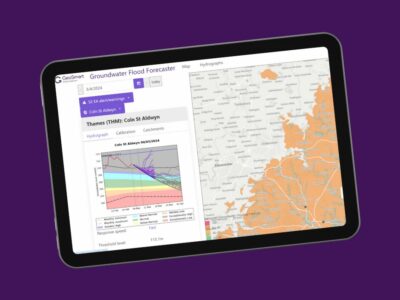
- Groundwater flooding – when water levels in the ground rise above surface levels, usually in areas underlain by permeable rocks, called aquifers. These can be extensive, regional aquifers, such as chalk or sandstone, or more local sand or river gravels in valley bottoms.
- Reservoir flooding – very rare but catastrophic if it happens. A large and sudden incident when the reservoir fails and floods land immediately downstream.
The Environment Agency’s Flood Map for Planning Purposes identifies the areas of land that would be subject to flooding, not including the presence of flood defences within the catchment. The assessment, which is primarily used as a planning tool, identifies land at risk from flooding using three Flood Zones – further guidance on their definitions can be found here.
The Environment Agency’s National Flood Risk Assessment (Risk of Flooding from the Rivers and the Sea) includes the extent to which flood defence structures reduce the chance of flooding and what might happen if they overtop or fail. The assessment identifies land at risk from flooding using four risk categories or Flood Zones (High, Moderate, Low and Very Low) and is predominantly used for insurance purposes.
These consider the chances of weather severe enough to cause a flood, and the likelihood this will overwhelm defence structures or lead to their failure.
In the light of accelerating climate change, The Environment Agency has also changed the river flow allowances for each flood zone category.
Planning policy
Technical guidance has been published alongside the newer National Planning Policy Framework (NPPF), while the PPS25 Practice Guide relating to flood and coastal risk management still applies.
The aim of the NPPF is to steer inappropriate development away from areas at risk of flooding, but where development is necessary, making it safe without increasing flood risk elsewhere.
This is achieved by applying sequential and exception tests at all levels of the planning process, from national and regional plans through to local plans and site plans.
The overall aim of the sequential test is to steer new development to Flood Zone 1.
If there are no reasonably available sites in a lower flood risk area through the sequential test, then the site may be subject to the exception test to establish whether:
- There are wider sustainability benefits to the community resulting from this development that outweigh the flood risks, and;
- A flood risk assessment has been undertaken that demonstrates that the development is safe and will not increase the risk of flooding
Flood risk assessment
Site-specific flood risk assessments (FRAs) are carried out by, or on behalf of, a developer to assess the risk to a development site and demonstrate how flood risk from all sources of flooding to the development itself and flood risk to others will be managed now, and taking climate change into account.
For new developments, NPPF describes a policy to avoid inappropriate development in areas at risk of flooding, and to direct development away from areas at highest risk.
However, where new development is by exception necessary in such areas, the policy aims to make it safe without increasing flood risk elsewhere and where possible, reducing flood risk overall.
Surface water management and SuDS
The key aims of ‘control’ within PPS25 are surface water management and flood risk management by design.
This means making best use of sustainable drainage systems (SuDS) and not increasing runoff rates leaving the site.
Developers will need to show options such as upstream storage and attenuation have been considered and justify why they are not suitable.
Surface water management provides an opportunity to reduce flood risk as a result of development and may contribute to the desirability of a proposal. The SuDS manual provides the industry standard guidance for design of Sustainable Drainage Solutions. The detail regarding surface water disposal within a flood risk assessment is again proportionate to the nature, scale and location of the development.
Next steps
Architects must work with their client to fully appraise the site, both in terms of flood risk (from all sources), as well as an assessment of the type of SuDS suitable for the site.
We can provide a combination of reports to cover both:
- Our FloodSmart flood risk reports provide analysis and interpretation of flood risk, based on the Flood Zone the site is in.
- Our SuDSmart reports provide an assessment of the potential for the site to absorb surface water locally and calculations needed for SuDS design.
Armed with this analysis, the most suitable project design can be achieved, while complying with the latest guidance and planning control.
For more information on our FRA and SuDS reports call us on 01743 298 100 or email enquiries@geosmartinfo.co.uk.


