Understanding Sewer Flood Risk from Groundwater
The Water UK Sewerage Infrastructure Network has launched an excellent, informative video for the general public and practitioners on the impact of groundwater flooding on the sewer network.
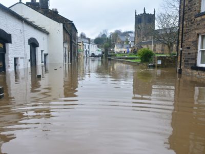
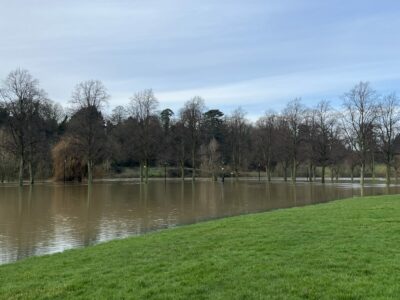
The video explains how groundwater collects in vulnerable parts of the UK, especially the chalk downlands of Southern and Eastern England. While it is a valuable water supply, once the water table is saturated, it emerges to charge Bournes, chalk streams that are normally dry in the summer, but can rise rapidly. Groundwater seepage can also create surface flows along roads and through properties.
But it is the impact on underground foul sewers that can be the most profound. Sewers are especially vulnerable to groundwater ingress forced through cracks in the access chambers or the pipes themselves.
The pipes aren’t designed to carry the groundwater load in addition and so can easily back up or create airlocks which mean that toilets and taps cannot work properly. At its worst, effluent could be pushed back up into the properties, creating a potential contamination hazard.
Because of the sheer scale of groundwater below ground, it presents significant management challenges. It can’t be easily stored or pumped from site, so the sewer system needs to be more resilient to ingress.
Sewers in vulnerable areas must be inspected closely and lined to ensure they are water tight, with priority given to particularly vulnerable areas.
The video explains the impacts of flooding while at the same time gives tips on what not to do to make matters worse.
Need to know if your site or property is at risk of groundwater flooding and could impact the local sewer system? GeoSmart offers bespoke desktop reports on groundwater flood risk using their GW5 National Groundwater Flood Risk Map, which identifies variations across a site to a 5m resolution.
GeoSmart is also uniquely providing UK’s first early warning system for sewer flooding due to groundwater inundation for the water industry. Called GWSewerFlood , it combines 50 years of borehole data, hydro-geological expertise and live telemetry feeds, modelling tracks actual borehole levels, weather forecasts and maps risk predictions up to 90 days in advance.
For more information on our groundwater flood risk map and modelling services, call us on 01743 298 100 or email enquiries@geosmartinfo.co.uk