Homes built on flood plains – needs must be balanced by risk
The UK’s population is set to grow by around another 10million people over the next 25 years, with the South and East of the country seeing most demand. In a region of extensive river and groundwater systems, there remains worrying evidence that developments continue to be built on flood plains.
National Planning Policy Framework (NPPF) and its associated Technical Guidance, categorises land into Flood Zone risks 1 to 3 according to the statistical chances of flooding in a given year. Planners are required to “seek opportunities to reduce the overall level of flood risk in the area through the layout and form of the development”.
The challenge is that in the drive to get houses built and satisfy local demand, these risks are, in some cases, getting overlooked, despite justifiable protest from the Environment Agency (EA).
Figures obtained by I news under the Freedom of Information Act show that more than 1,200 residential properties have been given a green-light after flood risk advice from the agency was fully or partially overruled in the five years since 2011/12.
The EA’s figures show that it has raised objections on flood risk grounds in more than 14,000 planning applications since 2011/12. Of those where a decision is known, the agency’s objections have been partially or fully overruled on 330 occasions.
On one occasion the planning application included nearly 1,000 homes, while on another occasion the development was for more than 500. Many of the properties were in Flood Zone 3 – the highest level of flood risk.
It should be said that this is a fraction of number of properties that the EA were consulted on since 2011/12, which was over 300,000. The same figures showed that in 2015/16 the EA were consulted on more than 66,000 new homes and in more than 99% of the time their advice was taken in to account when dealing with the planning application. The wider issue, though, is what their advice is based on. The use of river flooding zones largely excludes other flood risks, the most prominent of which relates to groundwater.
We recently revealed that in excess of £500million a year in economic loss occurs through groundwater flooding. So, while sites may be selected as they are in flood zone 1, they may also be at significant risk of groundwater flooding which can cause longer and more costly damage, which is in many cases, not covered by insurers.
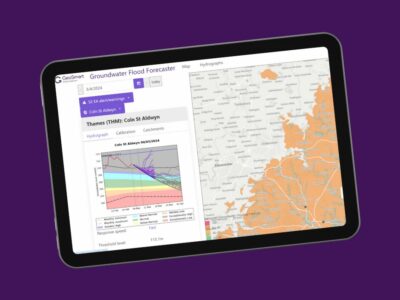
Developers, local authorities and homebuyers must all take greater heed of flooding from all sources and not be solely focused on a rivers-based flood risk approach. Detailed groundwater flood risk maps and site reports are available to help them appraise the site and any risks in situ.
The NPPF requires councils to avoid flood risk areas wherever possible. Where building in these areas is being considered, councils must ensure that suitable alternative sites at lower flood risk are not available, that new developments will be resistant to flooding and safe for its lifetime, and flood risk will not be increased elsewhere.
Mitigating flood risk through sustainable design
The NPPF continues that “Where building does take place on a floodplain, the local authority would need to be reassured that adequate defences were in place so that the risk of flooding would be minimised.”
While defences can mean barriers, non-return valves and air brick covers designed into the house build, sustainable drainage systems (SuDS) can do so much to mitigate surface flood risk within the development. Modest rainwater gardens, permeable paving and local soakaways that take little land, add to the quality of the streetscape and have been proven to minimise surface runoff to drains.
So, if there is a requirement to build in a sensitive area, SuDS are the obvious response. How this is stipulated varies by council, but there is a growing consensus that development must not make flooding worse elsewhere and SuDS can and do play a major role here.
Developers should work closely with Councils at pre-planning stage to understand if SuDS should be used as part of the on-site drainage strategy. To support this, appraising the site suitability for drainage will be crucial. Again, GeoSmart can help with SuDSmart reports, which include detailed runoff calculations and SuDS strategy design, as needed.
For more information on GeoSmart’s range of flood and sustainable drainage reports and data call 01743 298 100 or email enquiries@geosmartinfo.co.uk.


