What is a Drainage Assessment?
Contents
- What is surface water drainage?
- What is foul drainage?
- What is a drainage assessment?
- What is the SuDS hierarchy?
- What are the different steps of a drainage assessment?
- What follows a drainage assessment?
- How can GeoSmart help you to understand Site conditions better?
What is surface water drainage?
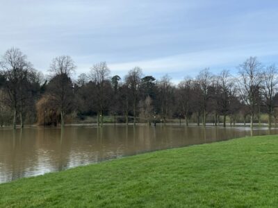
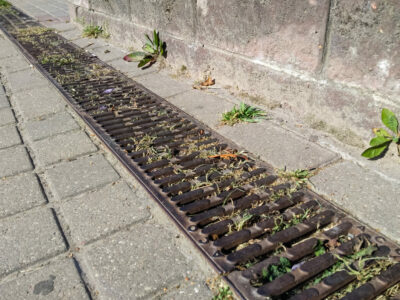
Surface water drainage refers to the drainage of rainwater and is crucial to the reduction of a Site’s surface water flood risks.
This is particularly the case for developments located on a Site where impermeable paving or surfaces are present as local heavy rainfall cannot infiltrate the ground and will overwhelm sewage systems.
It is therefore imperative that sustainable drainage assessments are undertaken to ensure the design of new developments in urban areas will not contribute to sewer flooding.
With the Flood and Water Management Act 2010, LPAs now work in conjunction with Lead Local Flood Authorities (LLFAs) to review developments and their impact on drainage.
Many take a pragmatic view on small developments (typically less than 10 dwellings), so LPAs and LLFAs will want to see a realistic drainage solution demonstrated.
Full testing and run off calculations could also be required but this will depend on the LPA involved.
What is foul drainage?
Foul water drainage is the pipework system that carries waste water away from a property and into the mains drainage system, if the property is connected to it.
From there, wastewater will be transferred to a local sewage treatment plant where it is processed and dispensed into the main water supply.
Any type of development that connects to the mains or a non-mains system will need a drainage assessment or statement to confirm the proposed arrangement.
This includes householder applications for additional bedrooms and/or bathrooms.
What is a drainage assessment?
A drainage assessment, also known as a sustainable drainage report or surface water drainage assessment, is a detailed document that analyses the existing drainage systems, identifies the risks and sensitivities which the Site may present and provides drainage solutions to safeguard the development and surrounding area.
Drainage assessments also help to outline sustainable ways to dispose of waste water, reduce the pollution of water supplies and manage surface water flooding.
This type of report is incredibly insightful and will take into consideration the SuDS hierarchy and a Site’s capacity for surface water attenuation to create a bespoke drainage scheme.
A drainage assessment is usually required by the Local Planning Authority (LPA) as part of the planning application so it is important that one is undertaken as soon as possible in the development process.
What is the SuDS hierarchy?
Developers need to follow a hierarchy of drainage options, as outlined by the government.
Where possible, preference should be given to multi-functional sustainable drainage systems, and to solutions that allow surface water to be discharged according to the following options:
- into the ground (infiltration);
- to a surface water body;
- to a surface water sewer, highway drain, or another drainage system;
- to a combined sewer.
The feasibility of the above options will depend on the Site’s geology, size, existing drainage system, and the existing and proposed development plans.
If infiltration is proposed, infiltration testing will more than likely be required as part of the planning application to prove this, with the rates provided to the Local Authority and/or drainage officer.
If discharge to sewer is proposed, a pre-development enquiry may need to be made with the local Utility Provider to confirm the sewer has sufficient capacity.
What are the different steps of a drainage assessment?
Development size
The first step of a drainage assessment is to determine the size of the planned development.
Minor developments can cumulatively affect flood risk and although smaller in size, can negatively impact the natural flow of water and heighten the chance flooding will happen in another area.
This is because there is an increasing demand on the capacity of surface water sewers and often the water company will not increase the capacity of the sewer.
Flood risks affecting smalls scale developments can be reduced by ensuring that:
- all hard-surfacing is made permeable.
- all minor developments should include plans which show down pipes connected to soakaways and/or other methods of control – not including the sewer.
- Front garden paving that is completely hard-surfaced is not considered a permitted development.
It is important to note that drainage assessments vary considerably between LPAs and will depend on the proposed size of the development, as well as the sensitivity of the local environment and topography to flooding or drainage issues.
For major developments, you will need to have an initial drainage assessment carried out and you could be required to complete a drainage assessment form by the LPA.
This form will need to be included in your planning application and can only be filled in after the drainage assessment has been carried out.
Detailed drainage design plans will typically need to be provided too and you will need to check if a flood risk assessment is required.
Flood zones
Once the size of the development has been established, the next step of a drainage assessment is to determine the flood zone that the building will be located within.
For developments situated in a flood zone 2, 3a or 3b – the functional floodplain – where the flood risks are higher, a drainage strategy will need to be tailored to ensure that runoff is reduced and managed effectively.
A flood risk assessment will also more than likely be required if any part of the Site is in a flood zone 2 or 3, or if the Site is larger than 1ha, in a critical drainage area or at a high risk of surface water flooding.
Critical Drainage Areas
The third stage of the drainage assessment is to identify whether the development will be built in a critical drainage area – a location which has been outlined to the LPA as having critical drainage issues.
These regions can cover wide areas of urban and rural environments and can be completely different or similar, to the areas identified by the Environment Agency as at risk of natural watercourse, river and sea flooding.
It is crucial for developers to understand if their Site is situated within a critical drainage area as they will need to ensure that surface water is managed to a greater level given the increased flood risk.
According to The Town and Country Planning (General Permitted Development) (England) Order 2015, the LPA must consult the Environment Agency where a development is in a flood zone 2 or 3 or ‘in an area within Flood Zone 1 which has critical drainage problems and which has been notified to the local planning authority by the Environment Agency.’
SuDS Calculations and Outline SuDS Strategy
The drainage assessment should also consider potential infiltration issues and include runoff volumes and flows for initial design.
Using site specific data, the effects of climate change (e.g., increased rainfall) should be considered using industry standard advice.
Clear recommendations will be provided for a drainage strategy specific to the Site layout and topography.
Finally, the suggested drainage strategy will be presented in an outline schematic depending on the results of the assessment.
What follows a drainage assessment?
After a drainage assessment has identified the drainage options available for a development, you will need a drainage design to map out how the drainage strategy will be implemented.
At GeoSmart, our Detailed Drainage Design report will provide you with in-depth details including pipe dimensions, cover and invert levels and gradients and will meet the specifications of LPAs and construction workers.
How can GeoSmart help you to understand Site conditions better?
GeoSmart provides architects, planning consultants and their developer clients with a comprehensive range of contaminated land, flood risk and drainage assessments to ascertain conditions ahead of full planning submission.
These can provide essential pre-screening of Sites for potential risks, through to providing a forensic approach to risk from surface, river and groundwater flooding and how these could affect Site drainage.
For more information contact us on 01743 581415 or email enquiries@geosmartinfo.co.uk.