Groundwater flooding season begins early
Prolonged rainfall in October and November 2019 has seen unprecedented rises in water levels across several parts of the UK including Lincolnshire, Yorkshire, Dorset, Wiltshire and Gloucestershire, meaning the groundwater flooding season appears to have begun early.
North Lincolnshire Council are reporting groundwater flooding around in Barrow upon Humber with sewer flooding and road closures including the main A18. The Environment Agency have issued flood alerts and warnings for Groundwater flooding in Barrow upon Humber and south of the Humber Estuary, the Cranborne Chase area and West Dorset.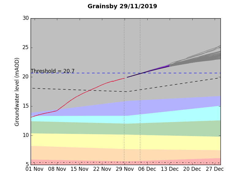 Figure 1. Continued rise predicted in the Chalk aquifer of North East Lincolnshire
Areas at risk of Groundwater Flooding
Groundwater levels in some locations have begun to rise earlier than usual, with levels already above those expected for this time of year. Groundwater flooding may last a long 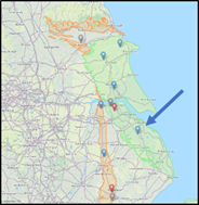 time from weeks to months. Further, more widespread, impacts from groundwater flooding may materialise down the line if significant rainfall continues through December and January, with the potential to cause the widespread impact seen during the winter of 2013/2014 across the south of the UK.
Based on Geosmart’s national groundwater flood risk map of most concern would be areas underlain by major aquifers such as the Chalk, the Cotswold Limestone and Lincolnshire Limestone. These aquifers extend across a wide area of England, from the south coast to the north east. Areas underlain by sandstone tend to have a more muted rise in groundwater level but can still give rise to flooding, particularly at spring lines and the boundary with less permeable underlying deposits of mudstone and clay. Also at risk are sites in river valleys where groundwater levels in permeable sand and gravel rise in response to high river levels, potentially by-passing the above ground flood defences.
The Groundwater Forecast
The Geosmart Groundwater Forecast has been used to assess the antecedent conditions liable to give rise to flooding this winter and by October there were signs that groundwater levels were going to rise above normal. Current predictions are for a continued rise in groundwater levels across north Lincolnshire and east Yorkshire over the next 30 days which could result in additional groundwater flooding, plus surcharging of drainage systems and sewers which could lead to an increase in flood risk from rainfall run-off, sewers and rivers. We are also predicting rising levels, well above the average in boreholes across the Wessex and Thames areas around Dorchester, Salisbury, Marlborough, Swindon and Cirencester.
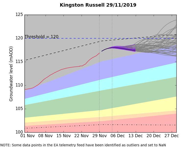
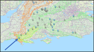
Figure 2. Levels approach flooding threshold levels in the Chalk aquifer of West Dorset
Groundwater impacts on the sewer system – North Lincolnshire
A Barrow Upon Humber Groundwater Flooding Community Newsletter has been produced to offer information and also practical guidance on flood response to residents in Barrow upon Humber and the surrounding areas.
Sewage flooding, potentially resulting from groundwater infiltration, is a significant issue requiring tankering of the excess water away. Anglian Water stated “Unfortunately, some residents in parts of New Holland and Barrow Upon Humber have been experiencing a loss of toilet facilities since the rainfall. Despite our engineers working to tanker the excess water away, the saturated ground and overwhelming of the sewer network, means that the water level is taking a long time to recede.” Those affected by sewage flooding are being urged to keep away from sewage. Pets should be kept away from the affected sites as and steps should be put in place to maintain hygiene, dispose of contaminated food and crops, avoid using affected gas and electrical appliances until checked.
Environmental impacts of flooding
Environmental Impacts as a result of the flooding can be significant with potential fuel spills, mobilisation of contaminants and emergency sewage discharge. At Barrow Upon Humber some groundwater is being pumped into the beck, which has been authorised by the Environment Agency because of the emergency situation. Once the emergency is over and discharges have ceased, Anglian Water will carry out a clean-up of the affected watercourses and the Environment Agency will ensure the environmental impacts are minimised as far as possible.
Groundwater flooding is also a possibility in the West of Dorset, Wiltshire and Gloucestershire.
Groundwater levels have continued to gradually rise over the last few weeks and with further rain forecast it is likely that groundwater levels will continue to rise and remain high. Three sites in the Wessex area ended the month in the ‘exceptionally high’ category for the time of year.
The Environment Agency are reporting that they expect to start to see groundwater ponding in fields and low lying areas as a result. Particularly in the South Winterbourne Valley and surrounding areas. At this stage they do not anticipate properties to flood but encourage residents with pumps and other property level protection to put them in place.
What is groundwater flooding?
The level of the water table changes with the seasons due to variations in long term rainfall and water abstraction. Groundwater flooding occurs when sub-surface water emerges from the ground at the surface or into Made Ground and structures. This may be as a result of persistent rainfall that recharges aquifers until they are full; or may be as a result of high river levels, or tides, driving water through near-surface deposits. Groundwater flooding is characterised by water flows to the surface or into basements, services ducts and other subsurface infrastructure rising up through floors or directly from the ground. This may be seen as diffuse seepage from the ground, as emergence of new springs or as an increase in spring flows.
Flooding may last a long time compared to surface water flooding, from weeks to months. Hence the amount of damage that is caused to property may be substantially higher. Likewise closures of access routes, roads, railways etc. may be prolonged. Further information is available on our knowledge hub.
Find out more about how GeoSmart can assist you this Groundwater flooding season here.


