Maintenance of Infrastructure Assets Using Geospatial Insights
GeoSmart’s Data Manager Jon Haycox attended the Maintenance of Infrastructure Assets Using Geospatial Insights Event in Birmingham this November.
The event, organised by KTN Geospatial Insights Special Interest Group, brought together organisations involved in looking after infrastructure assets through their lifetime (including infrastructure companies, local authorities, government agencies, insurance companies etc) with geospatial and space data companies with innovative capabilities for solving challenges faced in maintenance.
David Edgeton, a Historian at King’s College, delivered the morning keynote presentation on ‘The Culture and Value of Maintenance’. The talk gave context to the event presenting examples of maintenance in different cultures and highlighted that maintenance is often overlooked during the procurement processes and infrastructure commissioning. A panel session on The Challenges of Maintaining Infrastructure Assets followed. Ageing infrastructure and the difficulties encountered by assets built in the 60s and 70s requiring more maintenance was discussed. Another challenge was the interoperability of data and interdependency of models.
In The Role of Geospatial Insights to Support Decision Making panel session, examples of how geospatial technologies are being used were presented. A key point was the importance of users of the technology having authority to make decisions based on insights. Also, good stewardship of data was discussed and the need to be reactive and adaptive to change rather than wait for the next innovation. GeoSmart works with managers of infrastructure assets to review flood risk of portfolios to provide a classification of the risk plus clear and pragmatic advice regarding the potential significance and nature of flood hazards which may be present.
Steve Birdsall of Gaist gave a keynote talk on Geospatial Insights to Support UK’s Digital Transformation. Gaist provide insight into critical road infrastructure and undertake streetwise surveys for infrastructure, business intelligence and risk assessment. Using AI and big data technologies, road markings can be identified from video images.
A project update on the National Underground Asset Register (NUAR) Pilots was given by Holger Kessler of the Geospatial Commission. The aim of the NUAR project is to show where electricity and phone cables, and gas and water pipes are buried in order to prevent accidents and disrupt the economy. Three sources of value are recognised for opening data on underground assets: utility/strike avoidance; project efficiency; and, data exchange efficiency. The data could be also be useful for flood risk modelling and sewer network modelling. Two pilot projects are running in London and the North East of England. Geoff Zeiss had earlier talked about the Value of Good Statistics to Reduce Accidents in relation to utility strikes reviewing good practice in Japan, The Netherlands and Belgium. Issues around security and data delivery were discussed in a follow-up panel session.
The Building a Digital UK Panel Session included key themes such as digital twin, smart cities, the interoperability of data and systems, and data security. Discussions around the use of artificial intelligence and data bias were interesting and relevant given the increasing use of machine learning, deep learning and genetic algorithms in the geospatial sector.
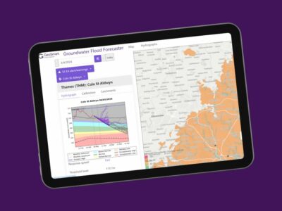
GeoSmart’s sewer infiltration forecast service is an example of a geospatial technology that can support decision making for infrastructure asset owners. The service is the UK’s first early warning system for sewer flooding due to groundwater inundation. Combining 50 years of borehole data, hydrogeological expertise and live telemetry feeds, our unique modelling tracks actual borehole levels, weather forecasts and maps risk predictions up to 90 days in advance. It provides advanced warning of groundwater flood risks to enable smarter resilience planning and provides critical answers on when and how long flooding could occur. Working with water companies, the service has provided actionable insights on infiltration rates and pumping, and integrates with other software for catchment modelling. We are keen to demonstrate the benefits of the service to infrastructure asset managers.
Find out more about how GeoSmart can assist you this Groundwater flooding season here.


