GeoSmart tests doorstep water level amid Shrewsbury flooding
Storm Franklin has caused flood devastation across many parts of the UK: people were evacuated from their homes, power cuts affected more than 12,000 properties and there were transport cancellations up and down the country.
A severe flood warning remains in place for Bewdley, Worcestershire, where flood barriers have been breached, while Rotherham Central Station has only just reopened after its tracks were submerged by water.
Parts of Matlock in Derbyshire were hit by the floods too, as well as areas of York, Doncaster, Ironbridge and London, to name a few.
Residents who have been trapped by rising water in areas of Shropshire and Worcestershire say this latest flooding is a calamity compounded by a lack of flood defences, house building on floodplains, and most significantly, climate change effects.
As our climate warms up, there is a greater risk of storms, heatwaves and wildfires. In the UK, river flooding is a potentially grave danger to many villages, towns and cities – both coastal and inland.
The floods we are experiencing now, as a result of Storms Dudley, Eunice and Franklin over the past few days, are a portent of what we could continue to experience, which is why, as a flood analytics company, we are so keen to understand and predict the risk factors, especially in flood zones.
With our enhanced graphical data system, we have analysed the flooding in Shrewsbury in more depth, determining the relation of our office to the main flood site through a digital model.
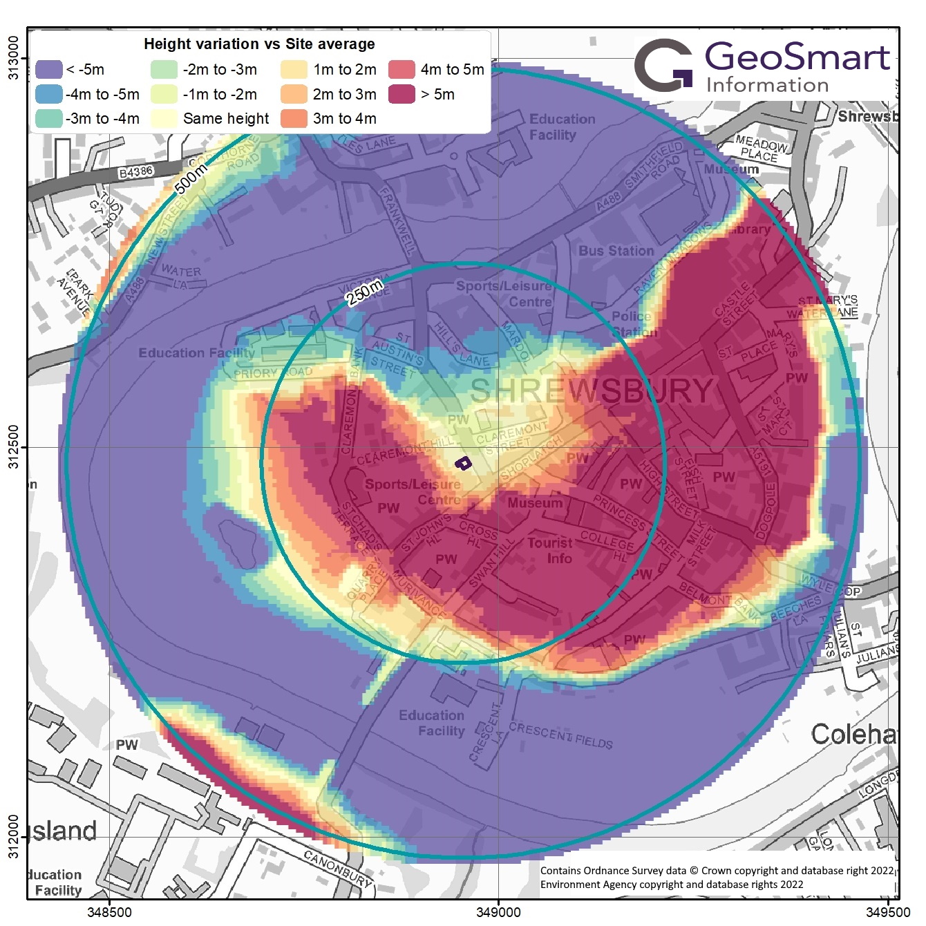
Flood testing with DTM
Using a specific 3D computer graphics data system, called a 5m resolution digital terrain model (DTM), we compared local flood levels with the threshold to the office.
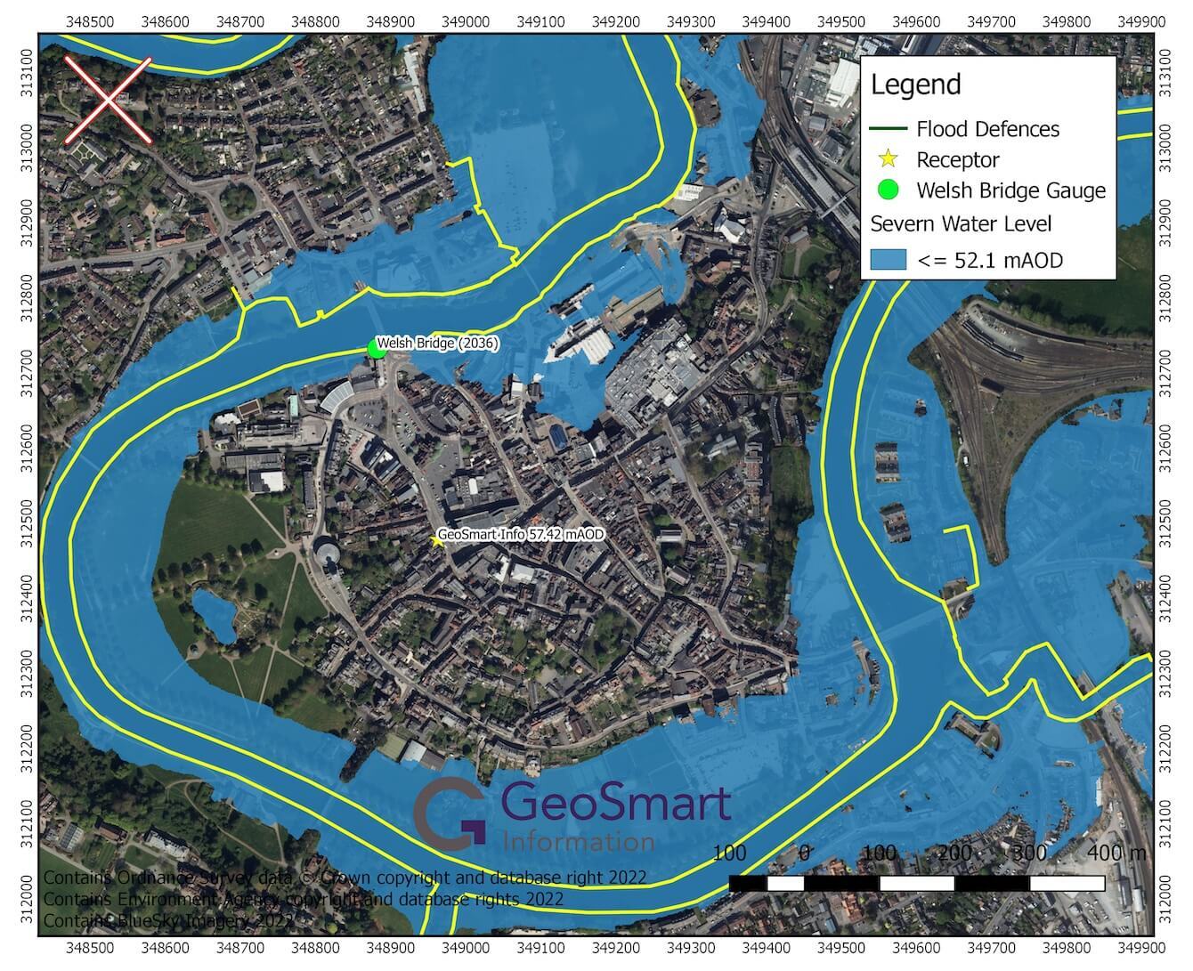
Colour coding identifies the relative level of our office to the surrounding topography and it shows that the office is at least 5 metres above the current flood levels that are washing across the road at nearby Frankwell – Welsh Bridge.
We produce visual data like this using our newly developed FloodSmart Analytics, which provides high-definition analysis for flood depths, probabilities and the costs of flooding from river, coastal, surface water and groundwater sources.
It means organisations across the financial services and insurance sectors – as well as individual property owners – can analyse the risk levels for buildings.
As the climate crisis becomes ever more pertinent, there will be an urgent need for more preventative measures for flooding. By the 2050s, nearly half a million more homes in the UK will be at risk of flooding.
It is why FloodSmart Analytics has never been more important. For more information about FloodSmart Analytics and how it could help your risk analysis, please contact us below.


