How is the climate crisis changing Britain’s coastline?
Contents
- Why are sea levels rising?
- What are the dangers posed by the rising sea level?
- What causes coastal erosion?
- Which areas of Britain are vulnerable to coastal erosion?
- What type of defences minimise coastal erosion?
- The future
Melting ice caps and the thermal expansion of our warming oceans have caused sea levels to rise by 102.3mm in just 30 years.
Study evidence published last week revealed this increase could be exacerbated further as water was discovered beneath the Antarctic ice sheet for the first time – a possible sign that the ice cap is thawing.
With the unabating production of carbon emissions giving no signs of slowing down, the global sea level will continue to rise and with it, the permanent alteration of the world’s coastlines.
According to NASA Sea Level Change Team member, Dr Sophie Nowicki, the inevitability of coastal change is now unavoidable and the need for humanity to acclimatise and prepare is essential.
“Sea-level rise has happened, and it will continue to rise. Our coasts are going to change. They are changing. So we need to find a way to adapt. The question is, how fast everything will change”, Dr Nowicki said.
Last month, the British Geology Survey (BGS) revealed their new product, GeoCoast, an integrated suite of Geographic Information System Mapping (GIS) datasets which provide information about our coast’s composition, structure and vulnerability.
Capable of enhancing the management of coastal erosion and flooding, datasets like GeoCoast will inform how Britain adapts to the challenges that pollution and global heating throw at its coastline.
Why are sea levels rising?
Mean sea level refers to the average height of the world’s oceanic surface between high and low tide and is a key indicator of the climate crisis.
In January 2002, the global sea level had risen by 28.2mm since 1993 – an increase which has more than doubled in the past twenty years.
In real time, we are witnessing the rise of the mean sea level as the gradual heating of the Earth’s temperature thaws our vital glaciers and ice sheets.
Whilst it is normal for the planet’s ice caps to melt a little during the summer period, the rate at which they are defrosting is alarming.
Both the Greenland and Antarctic ice sheets have been drastically losing mass since 2002, equating to 427 billion metric tonnes of ice collectively melting into the oceans.
The second main reason behind the dramatic increase of sea levels is thermal expansion, a process which causes water molecules in the sea to swell from the heat absorbed from greenhouse gases.
In 2021, our oceans were the warmest they have been since 1955 when modern record-keeping began.
With global heating and the thawing of ice sheets appearing relentless, the vulnerability of coastal communities to knock-on effects of the surging sea level will only worsen with time.
What are the dangers posed by the rising sea level?
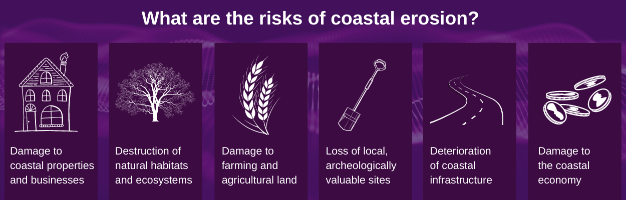
The main consequences of the increasing sea level are flooding and coastal erosion.
As the sea level rises, groundwater levels adjacent to the coast will heighten too.
GeoSmart have estimated that the presence of higher groundwater levels will significantly increase groundwater flooding and the inundation of sewers, the risks of which can be assessed in our GWFlood and GWSewerFlood systems respectively.
Global sea level rise will also have a huge impact on the structure of Britain’s coastline, with waves able to extend further inland and erode the coastal face faster and more frequently.
What causes coastal erosion?
Coastal erosion refers to the irreversible wearing down of rock, soil and land matter along the coastline by natural and manmade events.
Heightened sea levels, climate change-induced storms and heavier rainfall are all increasing the rate of coastal erosion, particularly affecting areas where the coastline is made up of softer sediments like the east English coast.
According to Aminpour, P. et al., urbanisation equally poses a threat to Britain’s coastal communities through its disruption to ecosystem functioning and the subsequent risk of “shoreline erosion, saltwater intrusion, storm surges, and coastal flooding”.
In a nutshell, the more infrastructure that is built to meet the demands of our growing population, the more our natural defence systems will be destroyed.
Which areas of Britain are vulnerable to coastal erosion?
With the inclusion of its islands, the Great British coastline is 31,368 km in length.
By the 2080s, 100,000 properties along this coastline are located in areas which will be at risk of coastal erosion according to estimations made by the Climate Change Committee.
Those most in danger are homes and businesses built near or on soft, sedimentary rock or low-lying coastal areas which are vulnerable to inundation (coastal flooding).
According to the British Geological Survey, 133 km² of Britain’s coastline is characterised as being highly susceptible to erosion – the majority of these areas lie in the east, south-east and north-east coasts.
Suffolk, Norfolk, Yorkshire and Dorset in particular have vulnerable coasts due to the presence of soft sandstone and limestone. Parts of the East Sussex coastline have also been outlined as being highly susceptible to coastal erosion, namely in Camber, according to a study conducted by Kantamenai et al.
Whilst all the above is important insight, you might be left wondering what measures are in place to protect and prevent the onset of erosion.
What type of defences minimise coastal erosion?
The process of protecting coastlines with man-made defences is an expensive venture and not a viable option for many countries. Such options include sea walls, groynes, revetments, steel mesh cages filled with rock matter known as gabions or breakwaters.
Sustainable and often more affordable defences include:
- Topping up sand and rock found on the shore with beach-grade sediments.
- Maintaining sand dunes with boardwalks, footpaths and ladders to reduce degradation of beaches by footfall.
- Accumulating sand dunes above drainage systems.
- Planting more trees and vegetation as a blockade.
- Water-sensitive urban design.
The future
As the climate crisis intensifies, it is important to understand the risks posed by coastal deterioration.
From homeowners to architects, the personal and economic losses caused by climate-induced coastal erosion and flooding will continue to be felt if awareness is not spread and further protective measures are not put in place.
For more information on coastal flooding or erosion, and more specifically, how GeoSmart’s flood risk assessments and flood risk systems can help you to avoid future problems, please contact one of our experts below.


