About
Our Team
Our Clients
Partnerships
Careers
Responsibility
Resources
CPD
Knowledge Hub
Blogs & News
Library
Case Studies
FAQs
Contact Us
01743 298100
enquiries@geosmartinfo.co.uk
Search:
FloodSmart
SuDSmart
Risk Management
MENU
MENU
Environmental Reports for Planning
Environmental Reports for Planning
Environmental reports to support planning applications, property transactions, the legal market, warranty and insurance purposes for property developers, planning consultants, architects, solicitors and environmental consultants.
Our report range is driven by three key requirements –affordable, accessible and accurate. All our reports comply with Local and National Guidance.
Whether you need a preliminary desktop analysis of site conditions or a more detailed Site visit, you can be assured of the very best guidance and clarity on next steps.
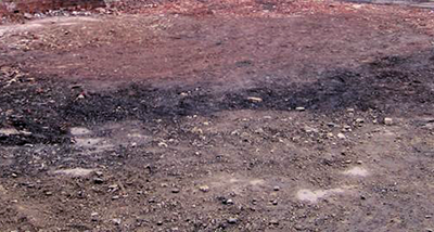
Contaminated Land Reports
Our Phase 1 Contaminated Land Reports assess whether a site has potential land quality issues, state who and what is at risk, and outline the solutions available.
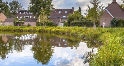
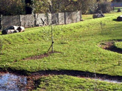
Sustainable Drainage Systems (SuDS)
Our SuDS reports help to assess which drainage options are available for a Site in order to comply with national regulations.
Detailed Drainage Design
Calculations and detailed drainage drawings for surface water and foul drainage systems.
Sequential and Exceptions Tests
Compares a proposed development site’s flood risk with other available sites. Features professional planning consultancy input.
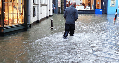
Flood Risk Assessments
Flood Risk Assessments designed to assess flood risk from all sources with clear mitigation measures.
Flood Consequence Assessments
Flood Consequence Assessments designed to assess flood risk from all sources with clear mitigation measures for sites in Wales.
Basement Impact Assessments
Reviews a proposed basement development and its potential impacts on surface water and groundwater flow and levels.
Groundwater Flood Risk
Maps and Flood Risk Reports specifically assessing risks of groundwater flooding to a Site.
CPDs
Every CPD topic we provide has been produced with property professionals in mind. They cover a range of environmental factors that should be considered when developing a site.
CPDs
Latest News
GeoSmart lauches new CPD on the risks of Flooding to property portfolios
GeoSmart celebrates promotion of two team members
GeoSmart Director discusses Groundwater flood risk with Instech
Expert Advice for Property & Transactions
Expert Advice for Property & Transactions
Professional advice suitable for property owners, transactions and due diligence. Manage your Environmental Risk from flooding, drainage, groundwater and contaminated land. Is the asset safe now and with future climate change?
We cater for property owners, surveyors, developers and solicitors. Clients gain awareness of issues ahead of completion or project start. Property owners increase understanding of the risk to their investment and the options for mitigation.
Consultancy for Due Diligence/Acquisition
Expert advice that identifies the risk of flooding, drainage provision and legacy of contaminated land. Highlights the impact of Climate Change and options for mitigating risks.
Detailed Consultancy, Modelling & Engineering Design
Professional analyses and consultancy reports. Flood modelling and event analyses and to support mitigation design. Our engineers model surface run off and provide detailed design of drainage and water management systems. Hydrogeological investigations and groundwater risk assessments. Expert Witness reports suitable for legal issues and representation at Inquiry.
Advice for Property Owners and Businesses
Specialist advice on environmental risks at your property. Understand the implications for site use. For sites mapped at flood risk or which have suffered from previous flooding, a range of mitigation and drainage options are available. Identify potential impacts on future asset value from Climate Change.
Spatial Analyses of Environmental Data & Intelligence
Expert spatial analyses of environmental information to add commercial value. Custom models and data sets developed for land evaluation and risk assessment. GIS support and training.
CPDs
CPDs
Every CPD topic we provide has been produced with property professionals in mind. They cover a range of environmental factors that should be considered when developing a site.
Latest News
GeoSmart lauches new CPD on the risks of Flooding to property portfolios
GeoSmart celebrates promotion of two team members
GeoSmart Director discusses Groundwater flood risk with Instech
Data & Services
Data and Services
Providing spatial data products and modelling services for asset and infrastructure managers, as well as environmental consultants needing to identify environmental risks to specific sites through to full coverage of Great Britain.
Water companies, developers and local authorities can screen sites and portfolios for risks as part of cost appraisals, scheme design and planning requirements.
FloodSmart Analytics
High resolution data for fluvial, pluvial, tidal and groundwater flood sources. Includes spatial data layers of flood depths and extents at multiple return periods. Also available as a database of flood metrics and risk indices for every GB property.
Groundwater Flood Risk Map
Incorporating comprehensive data on geology, permeability and historic groundwater levels, our GW5 map reveals potential susceptibility to groundwater emergence.
Groundwater Flood Forecasting
Our dynamic live modelling tracks actual borehole levels, weather forecasts. It outputs risk predictions, quantifies impacts to the sewer network and issues early warnings up to 90 days in advance.
SuDS Infiltration Suitability Map
Our unique SuDS Infiltration Suitability Map reveals the locations best suited for sustainable drainage to meet new compliance standards for planning submissions.
GIS Consultancy Services
As experts users of Geographic Information Systems we undertake spatial data projects, creating datasets, web mapping applications and augmented reality visualization tools.
BGS Geology Databases
As a trusted partner and reseller of British Geological Survey (BGS) data we can offer their full range of available datasets, at highly competitive prices.
User Guides
User Guides
User guides to accompany GeoSmart Data to help you get the most out of your reports.
Latest News
GeoSmart lauches new CPD on the risks of Flooding to property portfolios
GeoSmart celebrates promotion of two team members
GeoSmart Director discusses Groundwater flood risk with Instech
Risk Management for Financial Services
Risk Management for Financial Services
Flooding is a key risk in the financial sector which needs to be appropriately managed. Flood risk affects millions of properties and climate change is likely to increase risk in the future. Effective risk management depends on accurate data.
FloodSmart Analytics
High resolution data for fluvial, pluvial, tidal and groundwater flood sources. Includes spatial data layers of flood depths and extents at multiple return periods. Also available as a database of flood metrics and risk indices for every GB property.
Risk Selection
Flood risk data supporting risk selection, claims verification, pricing flood risk premiums, managing accumulations, and informing ceding decisions.
Consumer Understanding
Reporting that meets Consumer Duty (PS SS/29) expectations. Our data is particularly useful to consumers who may need specialist flood insurance or could benefit from Green Finance Initiative flood mitigation loans.
Commercial Property Portfolio – Flood Risk Screening
Flood Risk Assessments covering a portfolio of multiple sites. This screening can be used for specific asset types (e.g. infrastrucure) or for an entire portfolio of insurance policies or mortgaged properties.
Reporting and Disclosure
Recent developments in climate related disclosures include specific flood risk. Our data can assist with TCFD and ISSB S2 disclosure requirements.
Case Studies
Insurance Use
Finance/Lender Use
Latest News
GeoSmart lauches new CPD on the risks of Flooding to property portfolios
Mortgages: climate change, flood and insurance of UK homes after 2039
The Consumer Duty and climate change risk to property
About
Our Team
Our Clients
Partnerships
Careers
Responsibility
Resources
CPD
Knowledge Hub
Blogs & News
Library
Case Studies
FAQs
Contact Us
Property
Blog
,
Contaminated land
,
Property
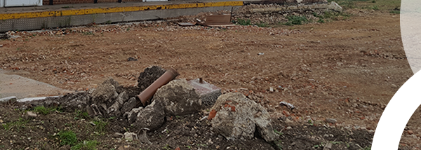
1 million plus homes can be delivered on brownfield land
15 Nov 2016
Blog
,
Flooding
,
Property
,
SuDS
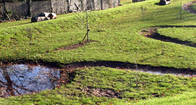
Understanding and working better with authorities on SuDS planning conditions
08 Nov 2016
Blog
,
Contaminated land
,
Property
Unlocking the land – brownfield land fund
18 Oct 2016
GW5
,
News
,
Property
Landmark Information Group enhance flood risk analysis with GeoSmart’s 5m…
10 Oct 2016
Blog
,
Property
,
SuDS
Sustainable Drainage Scheme conditions – what they look like and how to…
14 Sep 2016
Blog
,
Property
,
SuDS
Sustainable Drainage Scheme conditions – what they look like and how to…
13 Sep 2016
CPD
,
Property
,
SuDS
SuDS – working effectively with London Planning Authorities – 3 Nov
12 Sep 2016
Blog
,
Flooding
,
Property
,
SuDS
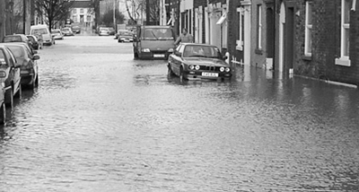
Flood Risk Guide
27 Jul 2016
News
,
Property
,
SuDS
Sustainable drainage and strategic flood risk council guidance – now added to…
17 Apr 2016
Blog
,
Climate change
,
Flooding
,
Property
Flood Zones Explained
24 Mar 2016
Blog
,
Contaminated land
,
Flooding
,
Property
,
SuDS
Understanding site viability for development
18 Feb 2016
Legal
,
News
,
Property
GeoSmart joins CoPSO as an executive member
01 Feb 2016
Blog
,
Legal
,
Property
,
SuDS
Understanding sustainable drainage systems
18 Nov 2015
Page 4 of 4
«
1
2
3
4