01743 298100
info@geosmartinfo.co.uk
GeoSmart Information
  • Home
  • Reports
    • Contaminated Land Reports
    • Flood Risk Assessments
    • Sustainable Drainage Reports
  • Data
    • Groundwater Flood Risk Map
    • SuDS Infiltration Map
    • BGS Geology Datasets
    • User Guides
  • Services
    • GWFlood
    • GWSewerFlood
    • Flood Risk Portfolio
  • Knowledge Hub
    • Contaminated Land
    • Flood Risk Assessment
    • Sustainable Drainage Systems
    • Groundwater Flood Risk
    • CPD
    • Videos
    • News
    • Events
    • Blog
    • Library
    • Case Studies
    • Latest GeoSmart e-Newsletters
  • About
    • Our Customers
    • Our Team
    • Our Partnerships
    • Testimonials
    • Careers
    • Our Responsibility
    • A Sustainable Future
    • FAQs
  • Contact

Sustainable Drainage Assessment for a Large Scale Development for Over 30 Residential Units

Posted in SuDSmart

We were tasked with assessing the drainage implications of a 2 hectare Site in Herefordshire and providing amenity benefits through the use of SuDS. Our SuDSmart Pro report was used to assess development of greenfield land into a key residential development and to provide a suitable level of detail to gain planning permission.

Our SuDSmart Pro assessment methodology enabled us to create a robust preliminary schematic for our client, which could be taken to the detailed design stage once initial planning permission had been obtained. Our assessment included the impact of flood risk to off-site receptors as a result of the increase in surface water runoff generated.

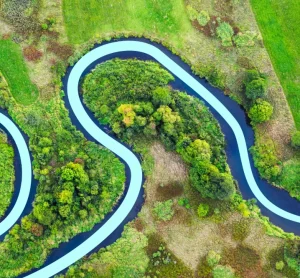
The existing land-use was used for agricultural grazing and was situated on a steep slope, adjacent to a stretch of highway. The Site was underlain by largely permeable geology comprising sandstone bedrock which was itself overlain with gravel member.

The size and topography of the Site required separation into two catchment areas to mimic the existing natural drainage regime. Since the Site was underlain by largely permeable bedrock and superficial geology, soakaways, swales and permeable paving were proposed as feasible options for attenuation and discharge of the excess runoff directly into the ground. A swale buffer and watercourse adjacent to the lowest area of the Site was used to slow the rate and catch any exceedance flows.

Existing and proposed impermeable ground cover (hard-standing) for the development and adoptable highway areas were obtained for the Site. These values were used to estimate the increase in surface water runoff generated following an extreme rainfall event taking the effects of future climate change into account.

These values were then used to calculate the required volume of water to be discharged on-site in line with national and local policy. The rainfall runoff calculations revealed that a total storage of over 370 m³ would achieve attenuation for the 1 in 100 year rainfall event with an allowance for climate change. The challenge here was to provide separate attenuation systems for the development and the adoptable highway, as well as splitting the catchments to provide a suitable reduction in discharge rates and provide attenuation to provide a SuDS scheme with real amenity benefits.

The hydrological and hydrogeological context of the development was reviewed to assess the potential for discharging the surface water runoff through a SuDS scheme and considered potential discharge routes and water quality requirements.

To manage the increase in runoff, we recommended a mixture of SuDS features that included a soakaway, swales and permeable paving. Advice was offered on the maintenance of the proposed featured which would then be finalised once a detailed scheme had been implemented. Alternative SuDS measures were proposed if, during further investigation, the original recommendations would not be feasibly practical for the Site. The features were sized appropriately to reduce the off-site runoff to the existing condition of the site. Assuming the scheme was implemented in line with our proposed plans, there was considered to be minimal off-site flood risk.

The layouts of the SuDS features were shown on a schematic plan of the proposed development and took into account the topography and underlying geology of the site.

An SuDSmart Pro Report costs just £995 plus VAT.

Share this Case Study
« Previous Post
Next Post »

Related Case Studies

Sustainable Drainage System (SuDS) Assessment
SuDS Assessment for a Commercial Home-Builder

See what our customers have to say...

"During the conveyancing process for my current house purchase, I was extremely concerned to find the general search results revealed the house was at 'moderate risk of groundwater flooding'. I was unable to get any further information from anyone until I contacted GeoSmart. The staff I spoke to were friendly, helpful, efficient and extremely knowledgeable. The information provided was very site specific and focused. The staff member who talked me through the information and maps provided was very knowledgeable, answered all my questions and allowed me plenty of time to discuss issues. Thanks to GeoSmart for their great service."
Linda Barton
"We were impressed by the speedy, well-informed service and personal contact that we received. The report was thorough and comprehensive. We will certainly use GeoSmart's services in the future"
Gregory Gray
Gregory Gray Associates
"I would like to say that dealing with GeoSmart was a seamless experience from beginning to end - thank you for that"
Martin Lloyd
Martin Lloyd Associates
"Everyone involved from initial approach to receipt of report was knowledgeable, efficient and focused"
Robert McCall
OeMO Ltd
"Great service! Extremely fast and the report was very detailed and well received by the planners. Many thanks GeoSmart, we will definitely use your services again"
Nigel Slack
Michael Eyres Partnership LLP
"The service was great, fast and efficient. Everyone we talked to was very helpful and the details were well received by the planners"
Ben Thorns
Solid Digital Marketing Ltd
"The service for a Phase 1 Contaminated Land Study was excellent, fast and efficient! GeoSmart were willing to assist despite the extremely tight timescale to work with. We will definitely consider using your services again"
Craig Roberts
Hunter Page
"Efficient and friendly service, GeoSmart provided a clear and concise report within the timescales advised. Great service and I would have no problem recommending"
Geraint Harris
Vitec Consult
"We are very pleased with the service provided by GeoSmart. Their reports have been used to assist with numerous planning applications and have always been delivered to budget and on-time, much to our clients’ appreciation. We look forward to working with GeoSmart on future projects"
Alan Gunne-Jones
Planning & Development Associates
"The service provided was efficient and friendly. From the first phone call to GeoSmart they provided a clear, professional approach to my request within the timescales advised. Great service and I would have no problem recommending"
John Childs
Private Developer
Find out more about how we can support you today!
Get in touch
Subscribe to our newsletter
© 2021 GeoSmart Information Ltd.

Suite 9-11, 1st Floor,
Old Bank Buildings,
Bellstone, Shrewsbury,
SY1 1HU

Company No. 5475394

Contact Us
Call 01743 298100
Email info@geosmartinfo.co.uk
Legal Links
  • Privacy Policy
  • CDM Regulations
  • Terms & Conditions
Website by Ascendancy Internet Marketing