
Environmental Modelling & GIS Services
Insights from the ground up
Our team of Geographic Information Systems (GIS) experts are available to undertake environmental modelling and spatial data projects.
Rated Excellent on Trustpilot

Our team of Geographic Information Systems (GIS) experts are available to undertake environmental modelling and spatial data projects.
Rated Excellent on Trustpilot
Our team of Geographic Information Systems (GIS) experts are available to undertake environmental modelling and spatial data projects. We provide geoprocessing services to create, analyze and maintain spatial datasets, develop web mapping applications, and build award winning augmented reality visualization tools.
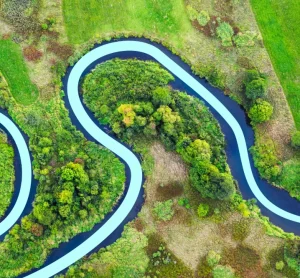
Spatial data has the power to unlock insights, solve problems and improve efficiency and data sharing within an organization. However, without specialist skills and knowledge choosing the right approach can be daunting. Our dynamic team has decades of experience in data processing, spatial analysis and cartographic visualization and can advise you on the right systems and data to meet your needs.
With more than a decade of teaching experience we can provide expert training for your staff in using GIS and data analysis so that you build capacity in your teams to complete business functions.
We provide cost effective no obligation proposals for all types of projects, large or small, or customizable training programs to fit your team’s needs.

Environmental reports provided.

UK property transactions used GeoSmart data.

Value of properties advised on flood risk

3D Visualization of Spatial Data within a real space.
Enables better interpretation of data.
Provides an intuitive and immersive user experience.
Facilitates high levels of engagement with stakeholders.
An ideal tool for consultations with experts and non-experts.
Well suited for communicating data stories at exhibitions.
Our application has won an Excellence in Innovation award at Flood Expo 2022.

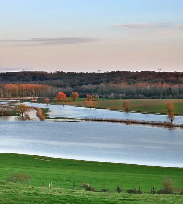
The production of multiple flood hazard layers.
Construction of a database with over 100 fields of flood attributes for tens of millions of addresses.
Developing automated workflows and quality assurance processes for easy ongoing maintenance of the data.
Building an online webmap front end software system for displaying and analysing flood data.
Creating a secure Application Programming Interface (API) for linking data seamlessly with third party systems.


“The service provided was efficient and friendly. From the first phone call to GeoSmart they provided a clear, professional approach to my request within the timescales advised. Great service and I would have no problem recommending”
“We are very pleased with the service provided by GeoSmart. Their reports have been used to assist with numerous planning applications and have always been delivered to budget and on-time, much to our clients’ appreciation. We look forward to working with GeoSmart on future projects.”
“Efficient and friendly service, GeoSmart provided a clear and concise report within the timescales advised. Great service and I would have no problem recommending”
“The service for a Phase 1 Contaminated Land Study was excellent, fast and efficient! GeoSmart were willing to assist despite the extremely tight timescale to work with. We will definitely consider using your services again”
“The service was great, fast and efficient. Everyone we talked to was very helpful and the details were well received by the planners”
“Great service! Extremely fast and the report was very detailed and well received by the planners. Many thanks GeoSmart, we will definitely use your services again”
“Everyone involved from initial approach to receipt of report was knowledgeable, efficient and focused”
“I would like to say that dealing with GeoSmart was a seamless experience from beginning to end – thank you for that”
“We were impressed by the speedy, well-informed service and personal contact that we received. The report was thorough and comprehensive. We will certainly use GeoSmart’s services in the future”
I was concerned to find out that my house was at a ‘moderate risk’ of groundwater flooding. I was unable to get any further information from anyone until I contacted GeoSmart. The staff I spoke to were friendly, helpful, efficient and extremely knowledgeable. The information provided was very site…
I now purchase GeoSmart’s Groundwater Flood Risk maps regularly – always a very speedy response to the both the initial request and, more importantly, delivery of the data! Excellent customer service too. The data is clear and extremely useful for flood risk assessments.
Brilliant customer service.
Browse our catalogue of white papers, technical guidance notes, and recorded CPD sessions. Each resource is available for individual download.