Exploring space derived data for improved flood forecasting

GeoSmart recently completed a second phase of research and development work funded by the UK Space Agency. Our team of data scientists and hydrologists explored the use of remotely sensed soil moisture data to improve and extend groundwater level forecasts for water resource management and disaster mitigation.
The work completed within this project has great potential to improve the accuracy of our groundwater forecasts in both flood and drought conditions. It can also improve the resilience of the forecasting system and our ability to provide continuous un-interrupted service, as well as increasing our ability to deploy the service in new areas of the UK and internationally.
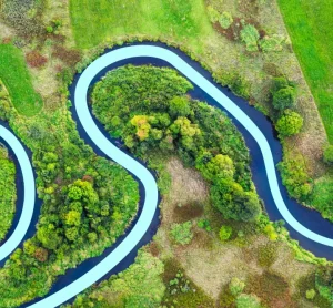
Establishing a relationship between soil moisture and water levels
The project focused on the interplay between soil moisture and river flow dynamics, particularly emphasising the influence of soil conditions on flood events across different gauging stations. Our findings reveal a consistent trend: wetter soil correlates with increased river swelling following rainfall. However, site-specific variations highlight the impact of local geological and environmental factors on soil moisture retention and runoff processes.
Analysis across various sites, using machine learning techniques, demonstrated the nuanced differences in soil moisture-river flow relationships across diverse soil compositions and terrain characteristics. High-baseflow sites, dominated by groundwater inflows, exhibit a less direct correlation between soil moisture and river flow due to the buffering effect of groundwater. Integrating groundwater data into analyses is crucial for understanding rainfall-river flow relationships in such locations.
Furthermore, the study underscores the importance of factors like land cover and soil type in shaping river flow responses to rainfall. While traditional hydrological models are complex, findings suggest potential for developing machine-learning models leveraging rainfall, evapotranspiration, soil moisture, and groundwater data to predict river flows, particularly at low-baseflow sites.
A digital service for monitoring soil and catchment conditions
Our conclusions highlighted the development of processes and algorithms to integrate surface soil moisture (SSM) data into groundwater and fluvial flood mapping and forecasting. Key outcomes include:
- Development of a surface soil moisture model calibrated against SSM data, with scope for further refinement.
- Testing of algorithms for assimilating SSM data into groundwater models, with plans for integration into live forecasting services.
- Utilisation of SSM data in machine-learning algorithms for simulating groundwater levels, with expected improvements from refined SSM estimates.
- Application of SSM data in extrapolating groundwater levels for flood mapping and forecasting.
- Recognition of SSM data’s relevance in analysing rainfall-runoff relationships for fluvial flow modelling, paving the way for future development of machine-learning models in fluvial flood forecasting.
Overall, the study underscores the potential of SSM data integration to enhance flood mapping, forecasting, and groundwater modelling, with implications for operational services and market expansion. Further research aims to refine models and expand services in flood prediction domains.
Innovative groundwater flood forecasting technology
GeoSmart was responsible for developing the UK’s first early warning system for groundwater and sewer flooding for property, infrastructure, and public service providers. Our forecasting system informs users of current and future water levels to provide an understanding of water scarcity and abundance.
Delivered through an interactive web mapping interface, the system enables alerting of predicted drought and flood risks. The technology can also be configured to incorporate sewer infiltration mapping, which is used by water utility companies to predict sewer groundwater inundation.