What is Groundwater Flood Forecasting?
As our climate changes, so do threats from flooding to where we live, work and run essential services. Groundwater flooding has been always been a struggle to predict, but with GWFlood forecasting, many people are starting to learn more about the risks and take action. We have launched GWFlood to help you plan and take action to safeguard property and ensure continuity of essential services.
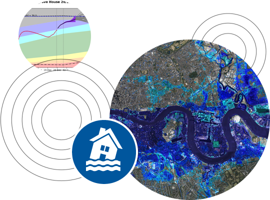
Combining 50 years of borehole data, hydrogeological expertise and live telemetry feeds, our unique modelling tracks actual borehole levels, weather forecasts and maps risk predictions up to 90 days in advance.
How is it used?
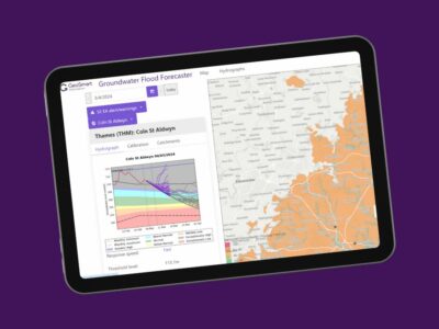
Our forecasting system is able to inform users on current and future water levels to provide an understanding of water scarcity and abundance. Delivered through an interactive web mapping interface the system enables alerting of predicted drought and flood risks.
The technology can also be configured to incorporate sewer infiltration mapping and is used by water utility companies for predicting sewer groundwater inundation.
Benefits
- Advanced warning of groundwater flood risks enables smarter resilience planning
- Provides critical answers on when and how long flooding could occur
- Bespoke mapping and reporting places your assets in the context of the likely future risk
- Technical support and expert analysis from in-house hydrogeologists delivers targeted advice for your management response
For more information on our unique GWFlood contact us today.
Frequently Asked Questions
We update our forecast every working day. This is sufficient when there are no imminent groundwater flooding incidents. If incidents are likely, or are occurring then we increase the service to daily, then twice daily. A weekly synopsis of the outlook for groundwater flooding is prepared by our experienced hydrogeologists in support of the daily forecasts.
Forecasts are provided on a regional scale for river catchments and sub-catchments. If you are interested in a particular community, or assets then the forecast can be delivered for each.We send you:
- The probability of groundwater flooding within 15 days.
- The most likely timescale (<15 days) until flooding commences.
- The quickest possible timescale in which flooding might commence.
We send the daily forecasts by email, which will include a link to download the forecast as a data file and catchment risk map. We also provide a web mapping interface.
A weekly synopsis report is provided reviewing the outlook and current groundwater situation with accompanying forecast groundwater hydrographs. The potential impact and duration of groundwater flooding events is reviewed as part of the report.
We currently deliver as csv files (one line for each catchment), ESRI shapefiles, and PNG images. In addition the web mapping interface gives a spatial overview of the forecast. Other file types can be delivered on request.
Our standard forecast is delivered for 302 river catchments across southern and south east England (soon to be c. 500 catchments from southern England to Yorkshire). But if you have a particular asset, community or location we can provide a specific forecast.
Yes – for a small set-up fee in addition to the annual licence we can enter your location into the system and generate a daily forecast for your specific location, community or asset.
A base map is used to highlight the forecast for groundwater flood-prone river valleys. The GeoSmart Groundwater Flood Risk Map can be used in tandem with the forecasts to highlight the particular locations within a catchment that might be at risk.
The GeoSmart groundwater forecast model combines historic climate and borehole data plus live telemetry feeds and daily updates of the most accurate ensemble weather forecasts. We use predicted groundwater levels to map risk predictions over a range of time scales for 5, 15, 30 and up to 90 days in advance. As with any weather forecast the uncertainty in the predictions increases with the extent of forward prediction. Results indicate the percentage likelihood that groundwater flooding will occur within the prescribed time period and potential flooding duration.
Threshold levels are set relative to the forecast groundwater elevations to indicate the likely onset of groundwater flooding. Where required additional threshold levels can be set by the client for specific assets or communities.
You can subscribe to get a forecast for one location, or on a wider regional scale. Contact us for licensing costs.
Further Information
- Example Forecast
- Infrastructure & Utilities
- Insurance


