Demolition and Replacement Scheme After Flood Damage – Worcestershire
We were commissioned to complete a combined EnviroSmart Plus and FloodSmart Pro Report to support our client by addressing a condition of planning which was attached to their application. Our report summarised potential risks to controlled waters and future users of the site, and levels of risk were identified and qualified through the formation of a preliminary risk assessment.
The site was located in close proximity to the River Severn and at constant threat of flooding. The planning condition was satisfied by our specialist consultants delivering a smoother path to permission.
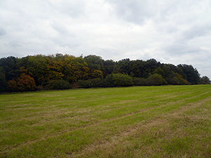
The site was located in a predominantly rural area in Worcestershire, adjacent to the River Severn and located in a Flood Zone 3 area.
The client was looking to demolish a late Victorian cottage which had suffered extensive damage from flooding during early 2014. The damage was so extensive as to leave it financially unviable to repair and no longer possible to insure against future flood damage.
The outline planning application was to demolish the cottage and then develop the site with a new dwelling on the same footprint as the original but raising the structure up on stilts to eliminate any future risk of flooding.
The Contaminated Land Officer at the Local Planning Authority imposed a planning condition that related to a contaminated land report and possible remediation as historical mapping showed the presence of a historic landfill in an adjacent field.
The landfill had been used for the disposal of building waste and silt from the dredging of the River Severn. Due to the site’s proximity to the river, contamination threats from the current building, and the proximity to the adjacent landfill, the Local Planning Authority stated that a Phase 1 Contaminated Land Assessment with a Site Walkover should be a condition of granting planning approval.
Our specialist land quality consultant undertook a study of historical maps to identify past uses at the location and vicinity in order to assess the likelihood of historical contamination. It was noted that a building had been present on the site since the earliest available map dated 1886 and had gone through several stages of development. A large pit was identified in the adjacent field which on later maps was labelled as a refuse tip.
The Contaminated Land Officer was contacted to identify and discuss specific concerns that related to the site. This ensured that when the report was submitted our recommendations were well informed and addressed the specific issues identified by the Local Planning Authority.
A full review of the available environmental data was conducted and this was combined with information gathered during the site visit and walkover survey to qualify any contamination risks posed. This approach enabled our specialist land quality consultants to collate an overall risk assessment which established the threat to individual receptors, such as groundwater, surface water, and future occupants of the site.
Following the identification of the receptors and the potential sources of contamination, the contaminant pathways were reviewed to ascertain if a linkage existed that presented a risk and to determine the level of risk where these had been identified.
Due to the high threat of flooding and the extent of the damage caused to the current property, a flood risk assessment was considered necessary to validate the extent of the flood threat and to confirm that the defensive measures of the proposed development were sufficient.
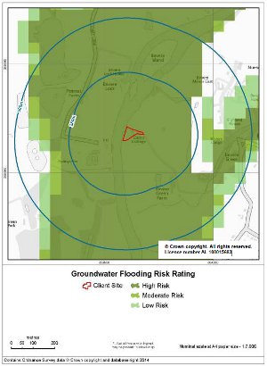
We studied the specialist data sets and historic flood events to compile a flood risk assessment and report for the site. The flood risk assessment indicated that the site was at high risk of flooding from both fluvial (river) and groundwater flooding.
The recommendations were that an evacuation route was required, where possible, to provide a safe access and egress route from areas within the flood zone to an area wholly outside the flood zone. Further to this it was recommended that the height of the ground floor level should be above 16.91m AOD.
As the proposed site plans provided by the client indicated that the floor level would be constructed higher than this, no changes were required to the development plans.
Conclusion
The report’s conclusion was that the level of risk for contaminated land was considered low for both on-site and off-site receptors, leading to a recommendation that no further assessment (including any intrusive investigations) of the site was deemed necessary in relation to the proposed development.
The flood risk assessment proved that, although the site is located in a Flood Zone 3 and at risk of both fluvial (river) and groundwater flooding, the steps taken by the client with the design and mitigation measures would be sufficient to meet the requirements of the Local Planning Authority and protect the property from future flood damage.
If you have a complex site that combines flood and contaminated land risk, contact us for a specific quote to combined FloodSmart and EnviroSmart reports in one.


