Environmental Constraints with Site Development
For architects, planning consultants and their developer clients, understanding the planning approach with environmental constraints such as contaminated land, flood risk and drainage can be bewildering.
We have developed a handy one-stop shop for guidance on your role, policy, assessing site conditions and managing through the planning application.
Understanding your Compliance Role
Significant variations exist at a national and local level on environmental risk assessment in planning applications for new development. We support architects and their clients by liaising with each local authority to ensure that our reports and recommendations are appropriate to standards at a national and local level.
We have captured these standards by country and local authority for you with our Guidance Library.
Site Environmental Constraints & Your Role 
You need to understand site suitability specific to the proposed development to answer planning submission obligations. Understanding pollution risk and having a clear mitigation plan is a key part of the contaminated land risk assessment in planning conditions.
Guidance from planning authorities now follow a clear drainage hierarchy, prioritising SuDS. Developers in a flood risk area must not make situations worse elsewhere. SuDS mitigate their effects and their inclusion in a scheme is viewed positively by planners.
You have a duty of care to advise your clients to meet operational compliance.
Contaminated Land 
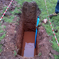
It is essential to review site history and assess land quality at the earliest stage for your client. If a potential pollution risk is identified for example through our historic site research in our EnviroSmart Report, then a site investigation can be undertaken to understand the nature of any possible contamination.
Read our Guides:
What is a Contaminated Land Risk Assessment?
- Investigating potential environmental liabilities related to a land purchase or sale.
- Identifying pollution links using a framework produced by the Environment Agency and followed by local councils and Planning Authorities.
What are the Stages of a Contaminated Land Risk Assessment?
- Identifying the stages of surveying, investigating and remediating sites.
Flooding
One of the biggest constraints will be flood risk zoning for development. Your role is to identify what the limitations are and the potential design responses where development would be allowed. Our Flood Risk Reports assess the site in the context of its flood zones, engagement with the regulators and review of the Local Authority’s Strategic Flood Risk Assessment.
Read our Guides:
- How Environment Agency flood zones impact on planning decisions
- How climate change is altering these zones
Do I Need a Flood Risk Assessment?
- Explaining the planning rules for flood risk in England, Wales & Scotland.
- Managing flood risk in Critical Drainage Areas
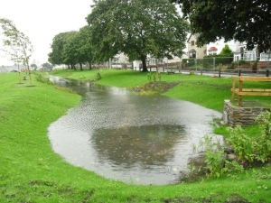 Sustainable Drainage (SuDS)
The site may require effective drainage with a series of natural features as a planning constraint. You may need to guide your client through this as you develop the scheme design and plot numbers as part of viability calculations.
Our tiered series of SuDSmart Reports provide a site drainage assessment, run off calculations and drainage strategy options for planning submissions.
Read our Guides:
What is a Drainage Strategy for Planning Applications
SuDS planning conditions – what do they look like?
In considering the site, contaminated land, flood risk and SuDS may interact with each other with potentially disastrous consequences if risks aren’t mitigated. This is why we often take a combined look at these together and ensure a holistic site appraisal.
Understanding the Site 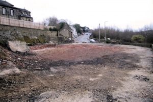
The essential next step – investigating site conditions to understand potential environmental constraints that could affect the economic viability of the development.
Our highly experienced team are specialist environmental consultants with training and experience to understand and support you or your client. We offer a cost effective and phased approach to site investigations that meets local authority compliance in support of your planning submission.
Site Assessment Reports from GeoSmart

Unlocking Brownfield Land Opportunity? Concerned about potential contamination?
Phase 1 land quality assessment with site walkover and planning history review

Could flood risk affect the development? What drainage strategy is needed?
Flood risk assessment with analysis of local strategic plans, engagement with the regulator and mitigation advice

Is the site suitable for sustainable drainage (SuDS) features? What design strategy could be needed?
Site evaluation, regulator policy consultation and SuDS design options
Develop your Understanding – CPD programme 
We run a popular, highly regarded series of webinars, accessible from your desktop. Make sure you and your colleagues are up to speed on the latest guidance and best practice.
 Case Studies
See how we have successfully helped our clients understand the site and potential environmental constraints and support their planning approach:
Mixed Use Land Assessment, Manchester
Flood Risk: Change of use in a London Flood Zone
Herefordshire SuDS assessment for large scale development
Get In Touch 
GeoSmart’s range of Site Assessments provide a comprehensive site risk analysis and support you and your client through planning submission and pre-planning enquiries.
For more information contact us on 01743 581415 or email us at enquiries@geosmartinfo.co.uk


