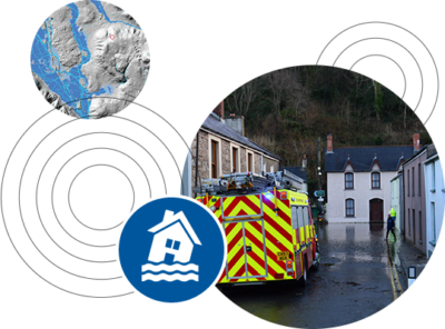
What is a Flood Consequence Assessment?
For architects, land surveyors and developers in Wales, it can be essential to provide a flood consequence assessment alongside planning permission applications. They support the site assessment development applications by looking at the risk and impact of flooding on a development site, helping to analyse the potential issues with building on sites, such as local areas having an increased chance of flooding.
For a development to take place, the flood risk report should prove that the site will remain safe in the future, taking the added effects of climate change into account when measuring the safety. When risks are found, the flood report can provide possible solutions to the risk of flooding on the development, helping you to plan and safely bypass these risks.
Choose the right report for you
Looking for the right Flood Consequence Assessment package for you? At GeoSmart, we have several assessment options, all giving clear flood management options and fast delivery times to help you prepare to manage risks that may occur on developments. Find out more about our different report options below.
FloodSmart Plus
- Flood Consequence Assessment (FCA)
- Medium to High flood risk area
FloodSmart Pro
- Flood Consequence Assessment (FCA)
- Medium to High flood risk area
- Site visit
Flood Risk Portfolio
POA
- Flood Consequence Assessment (FCA) for each Site provided
- Expert advice
- Site Visits (if required)
| Features included | FloodSmart From £1,095+VAT* Get a quote | FloodSmart Plus From £1,295+VAT* Get a quote | FloodSmart Pro From £1,995+VAT* Get a quote |
|---|---|---|---|
| Suitable for Flood Risk level | Low | Medium to High | Medium to High |
| Professional opinion from expert flood risk consultants | |||
| Consultation with regulators | |||
| Fast delivery time (working days) ** | 5-10 | 20-30 | 20-30 |
| Review of strategic flood risk assessment (SFRA) | |||
| Clear Flood mitigation and management options | |||
| £5 million PI | |||
| Supports Architects, Developers, Planning Consultants and the Legal Market | |||
| Natural Resources Wales (NRW) model data analysis | |||
| Flood levels | |||
| NRW Flood Defences | |||
| Site Visit |
* pricing based on site size, location & complexity
** Expedited turnarounds are available on request
Frequently Asked Questions
A Flood Consequence Assessment is required for any planning application in Wales where the site of the proposed development is located within a medium or high risk area of flooding. Such sites are considered to be at risk of flooding and Natural Resources Wales (NRW) and Welsh planning authorities have the power to challenge planning applications that have not taken into account all of the flood risks involved.
A Flood Consequence Assessment should demonstrate how a proposed development will manage flood risk from all possible water sources to the site in question. Changes in flood risk to off-site locations as a consequence of development should also be considered with recommendations provided to avoid increasing such risk.
Your site will be located in a Flood Zone as defined by Natural Resources Wales for planning purposes. To find out what Flood Zone your site is located in, input your postcode into the Development Advice Map available online.
- House builders and developers
- Property professionals such as architects, planning consultants and land agents
- Lawyers and solicitors
- Lenders, banks or mortgage providers
- Businesses
- Private individuals
- Insurance companies
- Validating planning applications
- Meeting planning conditions
- For land and property purchase
- For the sale or divestment of a site
- Due diligence
- Lending, mortgages, pension funds
- Business risk assessment
A FloodSmart Report for Sites located in a low risk area can be delivered in 5-10 working days.
Delivery of reports requiring NRW consultation and data (FloodSmart Plus and FloodSmart Pro) is dependent on their response times to supply such data, which can typically take up to 20 working days. Typically your flood risk report will be dispatched within 10 working days from receipt of the required data.
A premium delivery is available if your report is urgent – do get in touch and let us know.
Your report will be sent in electronic format as a .pdf file straight to your inbox, with hard copies available at an additional cost.
Welsh planning authorities are likely to request a Flood Consequence Assessment for any site which is situated on the modelled flood plain, and within the vicinity of a fluvial or tidal watercourse.
Flood Consequence Assessments are also requested in areas where there is a medium to high risk of surface water flooding.
Different levels of flood consequence assessment reports are required for different purposes. We’ve therefore developed a range of products which are suited to meet the various needs of our clients. If you’re not sure which level of report you need please contact us at enquiries@geosmartinfo.co.uk.

Still have questions? Chat to our friendly team today
Additional services available
- Sequential Test
- Exceptions Test
- Basement Impact Assessment
- Flood Modelling
- Portfolio Screening
- Flood Evacuation Plan
- Groundwater FRA
- BREAAM Flood Risk Assesssment
- Compensatory Floodplain Storage Analysis
- Coastal Change Vulnerability Assessment
Did you know, we also provide reports for:

Contaminated Land
EnviroSmart
EnviroSmart Plus
EnviroSmart Pro

Sustainable Drainage
SudSmart
SudSmart Plus
SudSmart Pro
We value the quality of all that we do as critically important and our team is goal oriented
Nigel Slack
Michael Eyres Partnership LLP
Gregory Gray
Gregory Gray Associates

We value and strive to achieve Service Excellence as the key to our success.