FloodSmart
Insurance Use

Also known as an FRA, a flood risk assessment is a key part of the site assessment and planning submission process and is required by the Local Planning Authority if the development will be situated in flood zones 2 or 3, in an area of one hectare or more in flood zone 1, is located within a critical drainage area or on a site where there is a risk of surface water flooding.
The main objectives of flood risk assessments are:
A good flood risk assessment will reveal whether a development can be constructed on a site by determining whether the area lies in a flood zone and assessing the proposed site’s topography.
Fundamentally, the assessment will provide a detailed analysis of available data on the site’s flood risk and will produce recommendations for flood mitigation actions.
The assessment will equally demonstrate consideration of flooding from all possible sources which include:
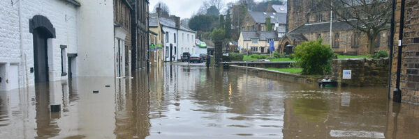
Our lowest tier of GeoSmart flood risk assessment is FloodSmart which is suitable for sites within a flood zone 1, sites which are larger than 1 hectare, critical drainage areas and sites with a high risk of surface water flooding.
This type of flood risk report can be delivered within 5-10 working days.
Our FloodSmart Plus and Floodsmart Pro reports are suitable for sites located in flood zones 2 and 3 and can be delivered within 20-30 working days.
We are required to request data from the Environment Agency which can take up to 20 working days to be provided.
Flood risk assessments are intended for:
According to government guidance, flood risk assessments need to be undertaken if developments are located within flood zones 2, 3 or 3b, if the site is more than one hectare and sits within flood zone 1 or situated in flood zone 1 area that will be at risk of river or sea flooding in the future, as determined by the Local Planning Authority’s SFRA (Strategic flood risk assessment).
In addition, an FRA will also be required if the development is situated in an area with critical drainage issues or has been shown by the Local Planning Authority to have a high vulnerability classification.
For the Welsh and Scottish flood risk maps, similar guidance applies.
In Wales, the Natural Resources website Wales provides a similar service to the English government where users can input a home or development site postcode to reveal the flood risk status.
Flood consequence assessments (FRC) are the alternative to FRAs in Wales as are the country’s flood zones which are based on the Development Advice Map (DAM).
In Scotland, according to section 42 of the Flood Risk Management (Scotland) Act 2009, flood risk assessments are required “where the application relates to a development that is likely to result in a material increase in the number of buildings at risk of being damaged by flooding.”
The Scottish Environment Protection Agency (SEPA) contains more information surrounding flood risk.
Aside from being required by the Local Planning Authority, FRAs are an important aspect of flood risk management to reduce the associated threats posed to humans and the environment.
Additionally, FRAs work to decrease the frequency of human and socio-economic losses.
Flood zones describe the areas in England which, to varying degrees, are more susceptible to flooding.
Created by the Environment Agency, the English flood risk map determines the different zones through various colours and will highlight which zone the postcode area you have inputted belongs to.
It is an essential tool for any flood risk consultant needing to provide flood risk assessment guidance.
The different flood zones are outline as follows:

We have many years experience in assessing flood risk and recommending next steps, as part of master planning and pre-application submissions.
We have a proven track record of delivering successful outcomes through our technical expertise.
Our flood risk assessment reports provide:
A Flood Risk Assessment is required for any planning application where the site of the proposed development is located within Flood Zones 2 or 3 as defined by the Environment Agency. Such sites are considered to be at risk of flooding and the Environment Agency and local planning authorities have the power to challenge planning applications that have not taken into account all of the flood risks involved.
A Flood Risk Assessment is also mandatory for sites of 1 hectare or greater in Flood Zone 1, and for smaller sites in an area within Flood Zone 1 which has critical drainage problems, as notified to the local planning authority by the Environment Agency. For further information on the relationship between Flood Zones and Flood Risk Assessments, see our news item Flood Zones Explained.
A Flood Risk Assessment should demonstrate how a proposed development will manage flood risk from all possible water sources to the site in question. Changes in flood risk to off-site locations as a consequence of development should also be considered with recommendations provided to avoid increasing such risk.

EnviroSmart
EnviroSmart Plus
EnviroSmart Pro

FloodSmart
FloodSmart Plus
FloodSmart Pro

SudSmart
SudSmart Plus
SudSmart Pro
Every CPD topic we provide has been produced with property professionals in mind.
Robert McCall
OeMO Ltd
Nigel Slack
Michael Eyres Partnership LLP

We value and strive to achieve Service Excellence as the key to our success.