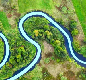
Groundwater flooding occurs when underground water levels rise above the surface, often after prolonged rainfall or seasonal changes. Whether you’re developing land or buying a property, understanding your groundwater flood risk is essential for long-term resilience and planning approval. We’ve compiled FAQs, case studies and guidance on groundwater and its effects.
Groundwater is any water which is located in between the pores and cracks of rock and soil beneath the Earth’s surface.
It is an essential source of water in the UK, contributing to approximately 30% of England’s public water supply – that’s enough to fill 2500 Olympic-sized swimming pools every day.
During periods of prolonged rainfall, groundwater levels rise as the earth becomes more saturated and water tables (the difference between the ground’s saturated and drier layers) become higher.
Typically, water tables are higher during winter and reach a peak saturation level in spring.
Groundwater flooding accounts for around 25% of all property and infrastructure risk, with wide-ranging and costly impacts, including:
Flooded basements and disrupted buried utilities.
Ground instability: subsidence, slope failures, and sinkholes.
Damage to wildlife habitats and farmland.
New springs, unexpected water flows, and surface flooding.
Sewer overloads causing pollution and service outages.
Contaminant spread from brownfield sites.
Increased construction costs and broader socio-economic disruption.
Climate change may worsen the situation by altering the groundwater recharge season (typically Sept–April). More rainfall in a shorter timeframe could raise groundwater levels more quickly, increasing saturation and flood risk.
Although it can occur pretty much anywhere, groundwater flooding is most frequent in areas of southern and eastern England, parts of the Cotswolds, East Yorkshire and the Eastern Pennines.
It is particularly prevalent where chalk, sandstone, localised sands or river gravel in the bottom of valleys are present.
Here at GeoSmart we can produce Groundwater Flood Risk Assessment Reports and Data specifically focusing on groundwater flood risk.
Unique, market leading data to understand groundwater flood risk
Combining comprehensive data on geology, permeability and historic groundwater levels
Another useful source for assessing whether you are at risk of groundwater flooding is through the Environment Agency’s flood risk reports and/or the monthly documents they publish on rainfall and river flow volumes.
If a site has an industrial past, groundwater flooding could cause contaminants in the soil to spread and come into contact with the building or people.
Equally, groundwater flooding can have an impact on surface water flood management and cause more damage in the event of heavy rainfall.
Understanding the site’s drainage characteristics and whether a sustainable drainage approach is needed (as determined by your Local Planning Authority) should be considered.
When groundwater levels are high, water can access the sewage system by pushing through cracks in pipes, joints, manholes or access chambers.
When this happens, the excess water puts pressure on the sewer’s capacity, increasing the risk of sewer flooding and posing a threat to local communities and businesses.
Sea levels are continuing to rise due to the increasing global temperature and a surge of up to 1m could be seen by the end of the century.
As a result, groundwater levels located in coastal and estuary locations will also rise, potentially causing damage to inland infrastructure.
Unexpected consequences could equally be seen if current defence systems become overwhelmed by future groundwater level surges.
Reducing yours or your client’s susceptibility to groundwater flood risk can be challenging considering it is not widely understood and requires expensive boreholes to measure.
However, there are several measures which can be undertaken to decrease the associated risks.
These include:
Understanding the impact of groundwater on property via a flood risk map
Seek improved insurance cover for groundwater risk
Designing and building property to account for groundwater risk
“The service provided was efficient and friendly. From the first phone call to GeoSmart they provided a clear, professional approach to my request within the timescales advised. Great service and I would have no problem recommending”
John Childs & Associates
Private Developer
“We are very pleased with the service provided by GeoSmart. Their reports have been used to assist with numerous planning applications and have always been delivered to budget and on-time, much to our clients’ appreciation. We look forward to working with GeoSmart on future projects.”
Planning + Development Associates
Planning & Development Associates
“Efficient and friendly service, GeoSmart provided a clear and concise report within the timescales advised. Great service and I would have no problem recommending”
Vitec Consult
Vitec Consult
“The service for a Phase 1 Contaminated Land Study was excellent, fast and efficient! GeoSmart were willing to assist despite the extremely tight timescale to work with. We will definitely consider using your services again”
Hunter Page Planning
Hunter Page
“The service was great, fast and efficient. Everyone we talked to was very helpful and the details were well received by the planners”
Solid Digital Marketing Ltd.
Solid Digital Marketing Ltd
“Great service! Extremely fast and the report was very detailed and well received by the planners. Many thanks GeoSmart, we will definitely use your services again”
Michael Eyres Partnership
Michael Eyres Partnership LLP
“Everyone involved from initial approach to receipt of report was knowledgeable, efficient and focused”
OeMO Ltd
OeMO Ltd
“I would like to say that dealing with GeoSmart was a seamless experience from beginning to end – thank you for that”
Martin Lloyd Associates
Martin Lloyd Associates
“We were impressed by the speedy, well-informed service and personal contact that we received. The report was thorough and comprehensive. We will certainly use GeoSmart’s services in the future”
Gregory Gray Associates
Gregory Gray Associates
I was concerned to find out that my house was at a ‘moderate risk’ of groundwater flooding. I was unable to get any further information from anyone until I contacted GeoSmart. The staff I spoke to were friendly, helpful, efficient and extremely knowledgeable. The information provided was very site…
Individual Developer
I now purchase GeoSmart’s Groundwater Flood Risk maps regularly – always a very speedy response to the both the initial request and, more importantly, delivery of the data! Excellent customer service too. The data is clear and extremely useful for flood risk assessments.